Water and Dowsers
Dowsers modernize their technique: they now find water by looking at digital maps

Efeagro/ Photo provided by José Luis De la Rosa
25 years ago José Luis De la Rosa discovered that he is capable of finding underground rivers, but unlike other dowsers he does not need to be in the countryside to feel the source, he just needs to use a digital mapping application.
He continues to use one of the usual instruments of dowsers to perceive the energy of water, the pendulum, but he does it on the screen of a computer or tablet.
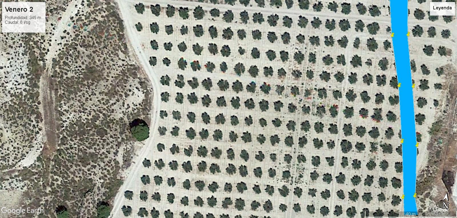
“I place the pendulum on top of the map as if it were on earth, I bring the image closer to where I want to pass the pendulum and when I detect the venero (underground river) I mark it,” De la Rosa tells Efeagro.
Only then does he go to the field to confirm the discovery with the rods (he does not use the other classic tool, the olive or almond branch) and mark the exact point at which to drill a well.
If the rods intersect, bingo! He has found water without having to travel through hectares of land, but rather by going directly to the exact place where, through digital maps, he felt that a river was passing underground.
It is not an esoteric science, De la Rosa emphasizes, it simply happens that when there is a vein, at whatever depth, it emits energy, and what a dowser does is capture it.
A SPECIAL SENSITIVITY CALLED RADIESTHESIA
At 50 years old, he has spent half his life perfecting the method with which he has already carried out a large number of surveys and all of them successfully, he says.
Their profile is very different from that of traditional dowsers in rural areas, of which there are fewer and fewer left, but the sensitivity is the same and it has a name, dowsing, and these “water magicians”, as the Egyptians called them, They have been displaying it since ancient times.
“People sometimes unfairly attack dowsers because they think they are uneducated people, but it is a sensitivity that one has. Just as there are people who have a special ability to play soccer or to develop a scientific career, well there are people who have this special sensitivity and you have to work on it and dedicate time to it,” he comments.
FROM CARTOGRAPHIC MAPS TO DIGITAL MAPS
De la Rosa discovered that he had this ability after meeting the Jesuit priest and parapsychology scholar José María Pilón, who told him that he found water for some nuns in Venezuela through a cartographic map.
He decided to test if he was also capable and it worked, and from there he developed his technique, making use of new technologies to analyze large farms, which allows him to delimit on the digital map the place where there is groundwater for then go on safe ground.
“You can even determine the depth of the well and more or less the flow, based on the energy emitted by the well and through experience, as well as by monitoring the behavior of the aquifer over time,” he comments.
This determining professional activity has different applications in very different sectors, so professional requests are diverse. De la Rosa explains to us that the most demanded activity is focused on finding water for the agricultural sector in the face of a field that dries up due to the lack of rain, and he is optimistic because he considers that there is much more underground water than is thought.
“There are many underground aquifers, many more than we can believe, but we must know how to exploit them and we must take care of the environment so that there is enough rain, since a very prolonged drought can lead to the disappearance of many of them,” he concludes.